Camping
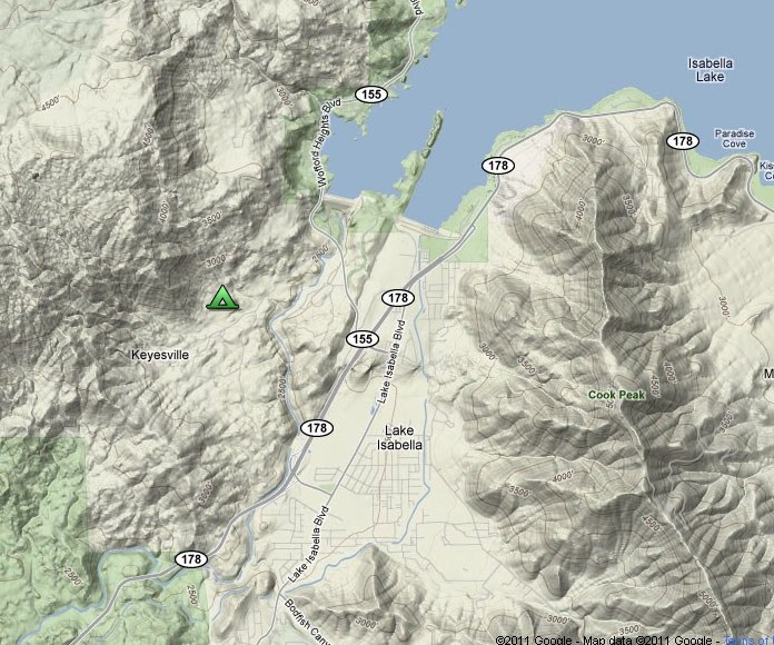
Thursday night, September 15 - Keyesville recreation area
We
have arranged group camping for the trip in the locations described
below. Please plan to bring along enough drinking water for your entire
group at each site, since these are all primitive camping facilities.
Port-o-lets will be provided at each camp.
We will be visiting a very
dry area in the middle of fire season, so please help reduce the fire
hazard by enjoying our main campfire instead of starting your own. If
you plan to use a camp stove on either Thursday or Friday night you will
need to get a fire permit from the US Forest Service--you can do this
online at http://www.fs.fed.us/r5/sequoia/passespermits/campfire_permit/campfire-index.html.
If you prefer not to camp,
there are comfortable accommodations available in Kernville. We
recommend talking to our friends at the Kern Lodge. There are grocery
stores in Lake Isabella on the main drag, and the James Store is located
on Sierra Highway in Kernville. Once we leave the Kern River Valley
midday on Saturday there won't be any resupply points until we get to
the small market/truck stop at Coso Junction.
As for the route, a 2WD should get you everywhere we plan to take you, but if you have a high clearance vehicle you might be more relaxed.
Directions:
From Lake Isabella,
California, travel north from the junction of CA-178 and CA-155 for 1.0
mi. Turn left into the Keyesville Recreation Area (Keyesville Road) soon
after crossing over the Kern River. Continue on Keyesville Road for 1.0
mi and turn right off the pavement onto Foot Hills Loop Road. Cross a
dry wash and head uphill, bearing generally to the left until you reach a
broad flat area. Keep to the left and find your friends on the south
side of the meadow [35.6317°, -118.5005°].
INformation
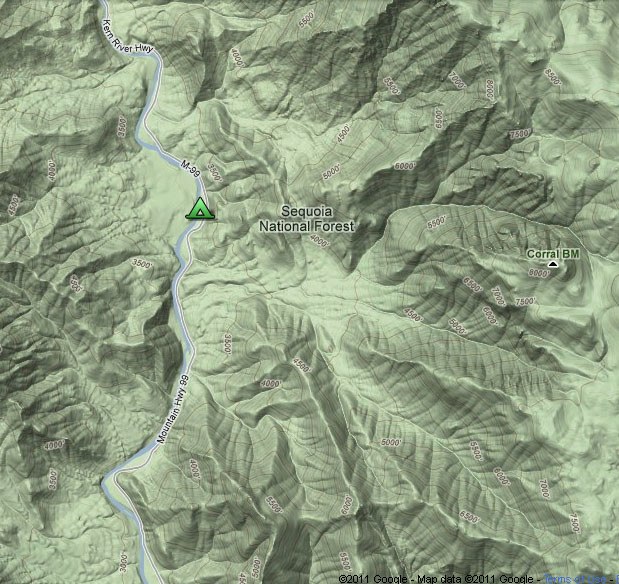
friday night, September 16 - corral Creek
Directions:
From Kernville, California,
go north from the junction of County Road 495 (Kernville Road) and
Mountain Highway 99 (Sierra Way) for 8.7 mi and turn left off pavement
into the Corral Creek Dispersed Camping Area [35.8618°, -118.4481°].
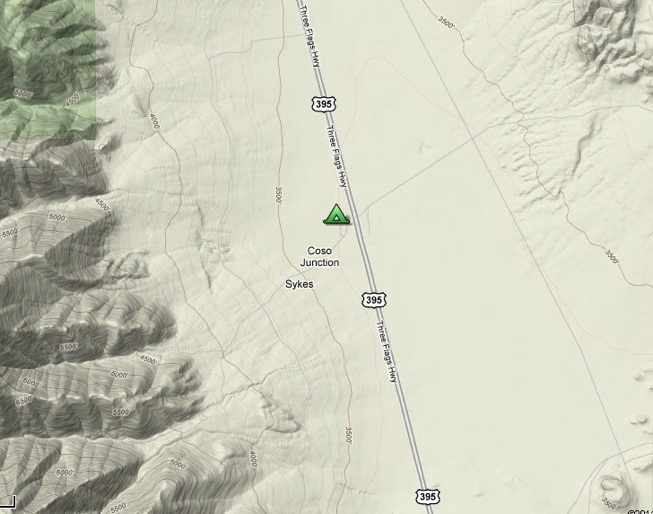
saturday night, September 17 - coso ranch
Directions:
On the west side of US-395
at Coso Junction is Sykes Road. Go west on Sykes Road for about 0.2 mi,
then turn right into the Coso Ranch. [36.0440°, -117.9512°].